RIAÑO and around.
October 2005
Select another
language
![]()
![]()
| iaño has belonged to the Regional Park of Picos de Europa since 1994. Located in the Cantabrian mountain range, it forms a major crossroads between the provinces of Leon, Asturias and Cantabria. |
|
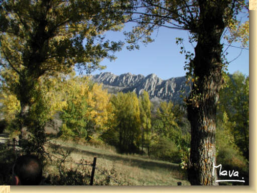
We are in an area surrounded by dense forests of beech and oak trees that form large areas on the slopes of mountain peaks and ridges, giving shelter to many animal species. In our three-day visit, we lodged at the Abedul guesthouse in Riaño, from where we made several trips to the surroundings of Riaño, towards the Picos de Europa National Park and to the province of Asturias.
|
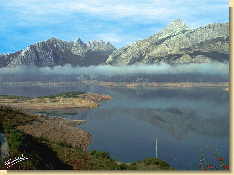
View of the reservoir of Riaño with the Yordas Peak (5.889 ft.) in the background, at right. |
 |
 |
|
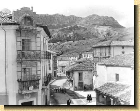
Riaño 1956. This picture was taken more than fifty years ago. View of the main street. A group of cows walk peacefully down the street. |
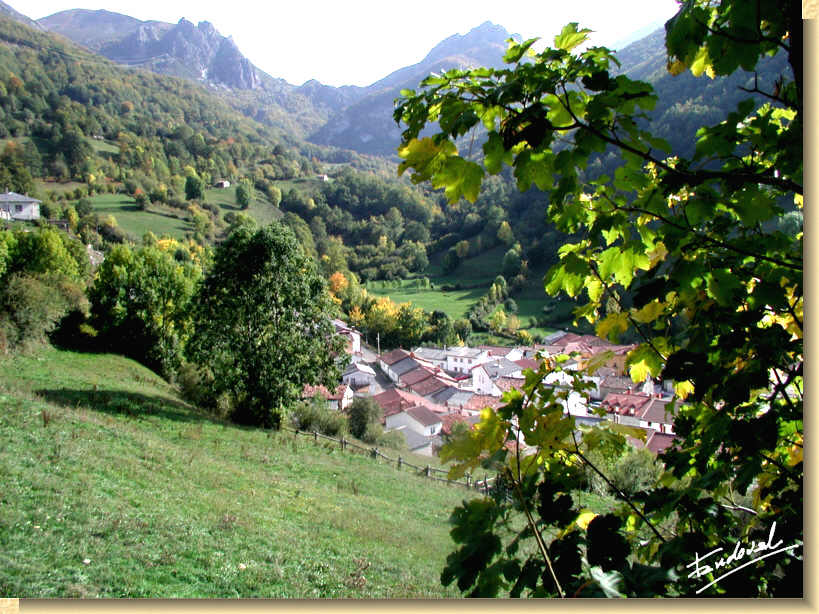
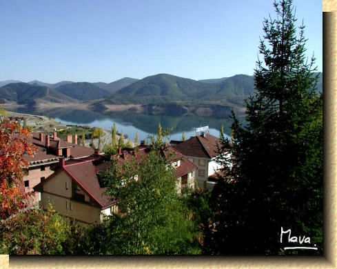
The New Riaño. View from Hostal Abedul of the dam and modern buildings surrounded by lush trees.
|
|
The
construction of the reservoir that bears his name is a turning point for
Riaño.
The primitive
village was settled in the vast and fertile land formed by the union of
the rivers Yuso and Esla. |
![]()
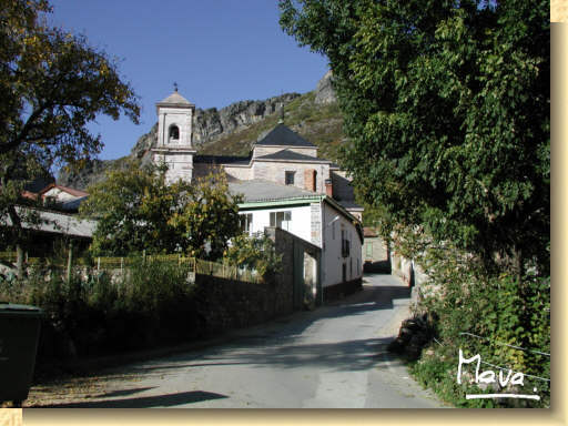
The entrance
to the village of Lois with its monumental church, known as the
cathedral of the mountain, in the background |
One of the first trips we made was to Lois following the course of the river Dueñas, in the valley of Crémenes.
(See map) |
|
|
Lois
is proud to own the "Cathedral of the Mountain", a monumental church
worthy of a visit. |
 |
 |
|
|
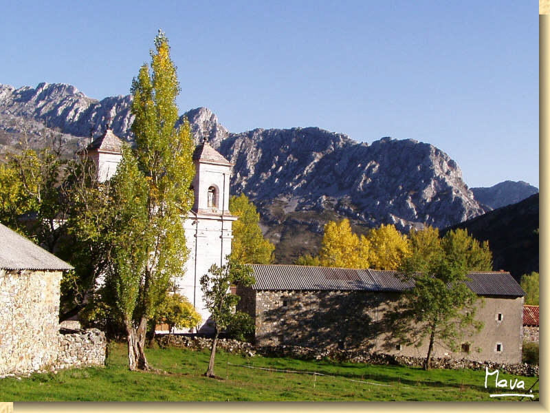
View of Lois with the "Cathedral of the Mountain" and the mountains of Riaño in the background. Note: Clic HERE to see the image at its original size (1240 x 768 pixels). |
![]()
Puerto de Panderruedas |
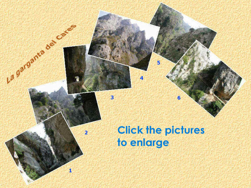
The next day we made a trip to Garganta
del Cares, in the
heart of Picos de Europa National Park. We drove away from Riaño by the
N-625 in the direction of Puerto del Pontón. Just before reaching it,
we took the road to Posada de Valdeón.
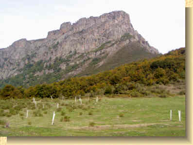
This road goes through the Puerto de Panderruedas, another mountain pass where we stopped for a moment to enjoy looking out over the valleys and the peaks of Picos de Europe, which appeared in all its majesty.
(See map) |
|
Massif Central region of the Picos de Europa
From Posada de Valdeón to Cain the road becomes narrower and very dangerous, especially in the last part near Cain. We begged not to find any other vehicle coming in the opposite direction; it would had been impossible to cross. The road ends in Cain where we left the car and, indeed, bought nuts, that were at their best at this time of the year. (See map)
The river Cares is born in Picos de Europa and, running northward through a gorge carved in the limestone cliffs, it forms an impressive canyon called La Garganta del Cares, also known as Garganta Divina (The Divine Throat) up to ending in the Cantabrian Sea. The route, without too much uphill work, is about 12 km. It circulates parallel to the river offering to walkers a really unforgettable scenery all the way. The track was made at the beginning of the last century by Eléctrica del Viesgo to monitor a water channel from Cain to the hydroelectric power station of Poncebos in Asturias. |
|
|
|
We began in Cain and walked for about 4 km. to return later to the starting point. There is a small dam at the beginning where water enters the channel. At this point the river and the pathway are at the same level. As we walked further the river became deeper and deeper in the valley, so the road runs a considerable heigh from the river. This part can be dangerous for people suffering from vertigo, since there is no protection at the border. In some places the rock walls are so close to each other that they can almost be touched with both arms stretched out (photo 1). We travelled several tunnels carved from the rocks with wide side openings letting in daylight (photos 3, 5 and 6), some of them difficult to pass. There are also several bridges that cross the river at great height providing wonderful views (picture 3). In some places the river is deafening noise and the height of the mountain summits almost conceal the sky (photos 1 and 3). There are trees coming up from the rocky crevices, keeping positions really implausible (picture 2). The rockslides are common (picture 4), being conveniently warned. It is not uncommon to surprise the flight of some bird of great size (eagle, vulture ...).
|
![]()
|
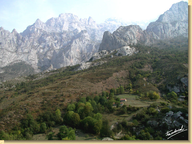
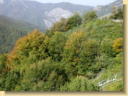
The last day of our stay we drove to the mountain pass Puerto de Tarna, natural boundary that separates the provinces of Leon from Asturias. From there we continue down the AS-17 to the village Campo de Caso following the course of the River Nalón. (See map) The Puerto de Tarna, located at 1,490 m. altitude, belongs to the council of Caso in the Nature Reserve of Redes. This park includes almost all the Nalón River Basin.
|
 |
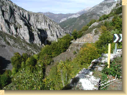 |
Going down the Asturian side, summits
get softened. There are
remnants of glaciers circuses. |
|
Note: Clic HERE to see the image at its original size (1240 x 930 pixels).
|
|
Finally, we arrived at the village Campo de Caso in Asturias, which was holding a market, and, after visiting a craftsmanship show, and spending there the rest of the day, we returned back to Riaño.
(See map)
|
|
![]()