Los Ancares and Sierra del Courel.
September 2004 Select
another language ![]()
![]()
![]()
Los Ancares
 |
ntil recently Los Ancares was a remote region in the world, poor and forgotten until it was discovered for tourism that found in it a natural area of rare beauty. |
|
Travelling to Los Ancares, in the province of Lugo, is penetrating deeper Galicia, where it is still possible to find places that captivate by the stunning beauty of landscapes, by the fascination and magic of their forests, refuge of endangered species, and for the excellent preservation of the rural environment. Their villages, lost in secular isolation, are a true reflection of primitive life, permanent testimony of the struggle for survival of man. It proved to be one of the trips that caused us the greatest impact. Los Ancares received the UNESCO Biosphere Reserve designation in 2006.
|
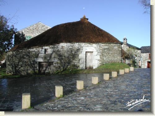 Palloza in O Cebreiro |
Our journey began in O Cebreiro. This village, located in the Pilgrim's route (camino de Santiago), still retains some pallozas (ancient thatched dwellings) that were inhabited until well into the twentieth century. We travel northwards following a route parallel to the mountains of Serra dos Ancares, passing through the villages of Doiras and A Degrada, as far as Piornedo, located not far from the limits with the province of León.
(See map)
|
|
|
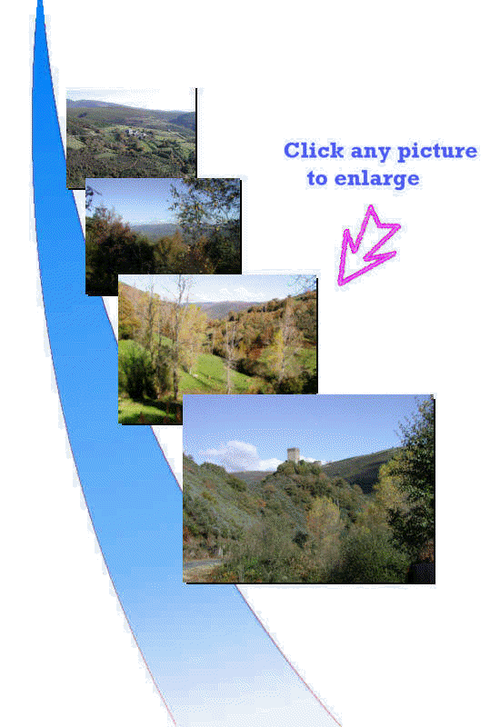 |
As you may have seen from our images, the vegetation covers almost the entire floor. We found extensive shady hillsides where autochthonous tree species such as ash, holly, oak, maple, hazelnut, walnut ...were abundant. And as it was autumn, many of them still retained the yellow and red leaves proper of this time. There is a great variety of animals that inhabit these hills. Raptors are abundant and we had the opportunity to see some of them as the goshawk and others not identified. The deer and chamois seem to be present and, as we were told, the bear was seen on occasion.
|
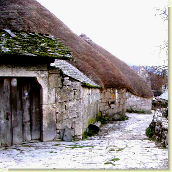 |
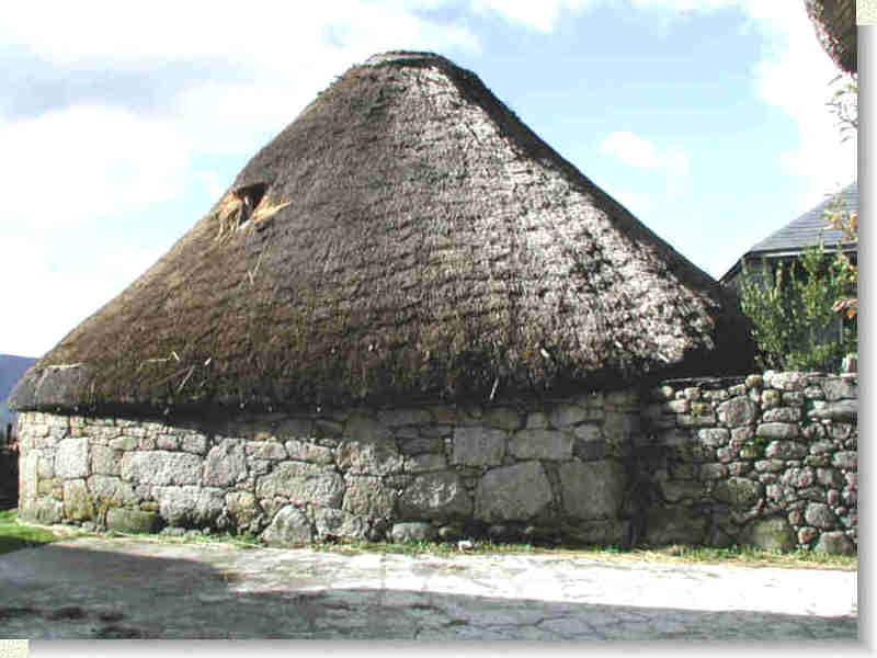
Pallozas in Piornedo |
|
Piornedo has the largest number of pallozas which still remain in Galicia. Some of them inhabited well until the second half of the 20th century.
They are circular with thick stone walls and conical roof (teito) made
entirely on rye straw supported on a wooden frame. The origin is pre-Roman and most probably celtic.
It was the housing par excellence where people and animals lived
together. |
 |
 |
 |
 |
|
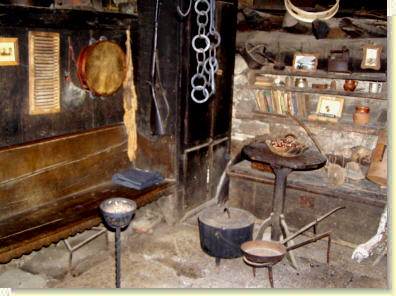
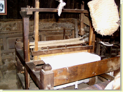
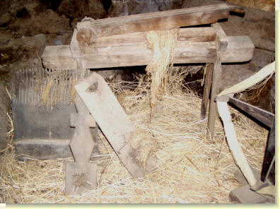
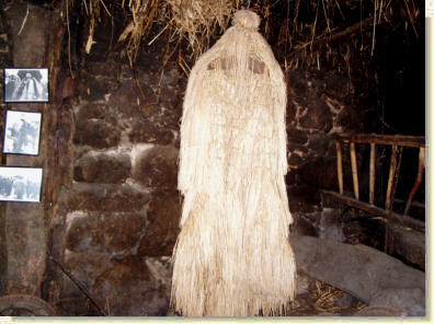
In Piornedo we had a chance to visit one of the pallozas-museum
where several tools are still kept. In the pictures above, the
living corner is at top on the left, the loom (tear) is at top
on the right,
tools to work flax (tasca, ripión and restelo)
are below left, and the coroza, some kind of raincoat made of
rush to protect from cold and rain, is below right. |
|
|
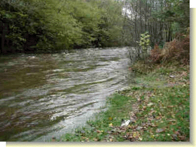
We return following the road that goes from A Degrada to Cervantes, following later the course of the river Navia as far as Becerreá. The fall was in all its splendor.
|
|
|
 |
 |
|
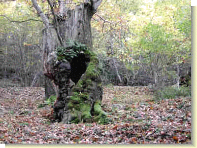
An old tree (castiñeiro) covered with moss The river Navia
|
|
![]()
Serra do Courel
|
Serra do Courel extends southwards, the other hand of the main highway N-VI, from Pedrafita do Cebreiro as far as Quiroga, in the province of Lugo. Well known for its rich landscape, it presents the most rugged mountains of Los Ancares and deep valleys through which runs the river Lor tributary of the river Sil. It is an area that has a large number of botanical varieties offering refuge to many species of birds and mammals.
|
|
|
|
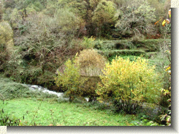
Clic HERE to see this image at original size The day chosen for our visit was cloudy. Deep in the valleys chestnuts, dressed for autumn, covered hillsides mingling with fog broken in shreds.
|
 |
 |
|
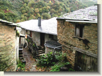
Following the road LU-651, that lead us into Courel's heart, we stopped in Seoane, continuing thereafter as far as Folgoso do Courel, crossing hamlets and ancient villages with their black slate roofs and always accompanied by the river Lor and the numerous rushing cascades pouring on it. Clic HERE to see more images of Serra do Courel.
|
|
![]()
Sugested links
In English:
In Spanish: